Ancient Corals and Ith Tower ©Yuriy Buriak
The mountain you will be walking along is actually a Jurassic coral reef. But you can see it only from above, here is a photo from the drone.

Ancient Corals and Ith Tower ©Yuriy Buriak
If you look carefully, you can even find huge petrified corals. Actually, everything is coral, but some stones remind them very much.

Ancient Corals and Ith Tower ©Yuriy Buriak
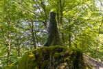
Along the way, you will meet quite a lot rocks, all of them have the common name Bisperoder Klippen. A popular place for climbers.

Ancient Corals and Ith Tower ©Yuriy Buriak

Ancient Corals and Ith Tower ©Yuriy Buriak

Ancient Corals and Ith Tower ©Yuriy Buriak
The end point of the route is the Ith Tower. It was first built here of wood in 1885. Like other similar towers in the region, it was built specifically for tourists, and funds for the construction were collected as donations.

Ancient Corals and Ith Tower ©Yuriy Buriak

Ancient Corals and Ith Tower ©Yuriy Buriak
In 1905, it was decided to raise money for a stone tower and its construction was completed in 1912 at the highest point of the ridge - Krüllbrink (439 meters above sea level). The tower is open 24h.

Ancient Corals and Ith Tower ©Yuriy Buriak
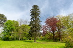
Although not as good as from a drone, you can see the outlines of coral mountains from the tower.

Ancient Corals and Ith Tower ©Yuriy Buriak
This, by the way, is a good example for everyone who wants to attract tourists, but does not have any historical or cultural places in their region. Make a parking, a trail, some kind of end point and thousands of people will visit your region. And if there is still a toilet, information plates and a restaurant, then tourists from abroad will come.

Ancient Corals and Ith Tower ©Yuriy Buriak
To avoid getting lost, use this map and follow the Ith-Kammweg trail. It can also be downloaded to your phone as a Maps.Me app.
Getting there: we parked near the restaurant, here N 52 06.924 E 9 31.921. Then 4.5 kilometers on foot. Nearby, there is a bus stop Felsenkeller, Coppenbrügge. Use bahn.de.