Salar de Tara lake ©Yuriy Buriak
It is dangerous for many reasons. In case of Geysers del Tatio or Miscanti Lagoon you climb to a height of 4200 meters then walk for an hour or two on the spot and start the descent.
This trip took us 7 hours and 6 hours we were at altitudes of 4600-4900 meters! This is a lot for an unprepared tourist. If you feel bad, there is no help from anywhere. When we return back we were in poor condition and had to drink headache tablets.
This driver lost consciousness at an altitude of 4850 meters.

Accident in the Atacama Desert ©Yuriy Buriak
We left early in the morning, before dawn. Pre-filled a full tank, took water, food and medicine.

The road to Salar de Tara lake ©Yuriy Buriak
Pretty fast reached the plateau.

The road to Salar de Tara lake ©Yuriy Buriak
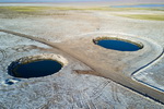
There we decided to test the drone at altitudes above 5000 meters. As it turned out drone flies without any problems. From above we saw the fog. Where does it come from at such an altitude? There is no rain here and therefore water.

The road to Salar de Tara lake ©Yuriy Buriak
Take into account one little-known fact. At high altitude your car will lose power and speed uphill will drop to 20-30 km per hour.

The road to Salar de Tara lake ©Yuriy Buriak
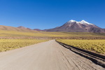
The first part of the way is pretty easy and the road is excellent. Turn is here S 23 03.618 W 67 29.168, you can reach this place by any car. Here located the interesting stone formations Monks of Pacana (Monjes de la Pacana).

Monjes de la Pacana (Pacana Monks) ©Yuriy Buriak
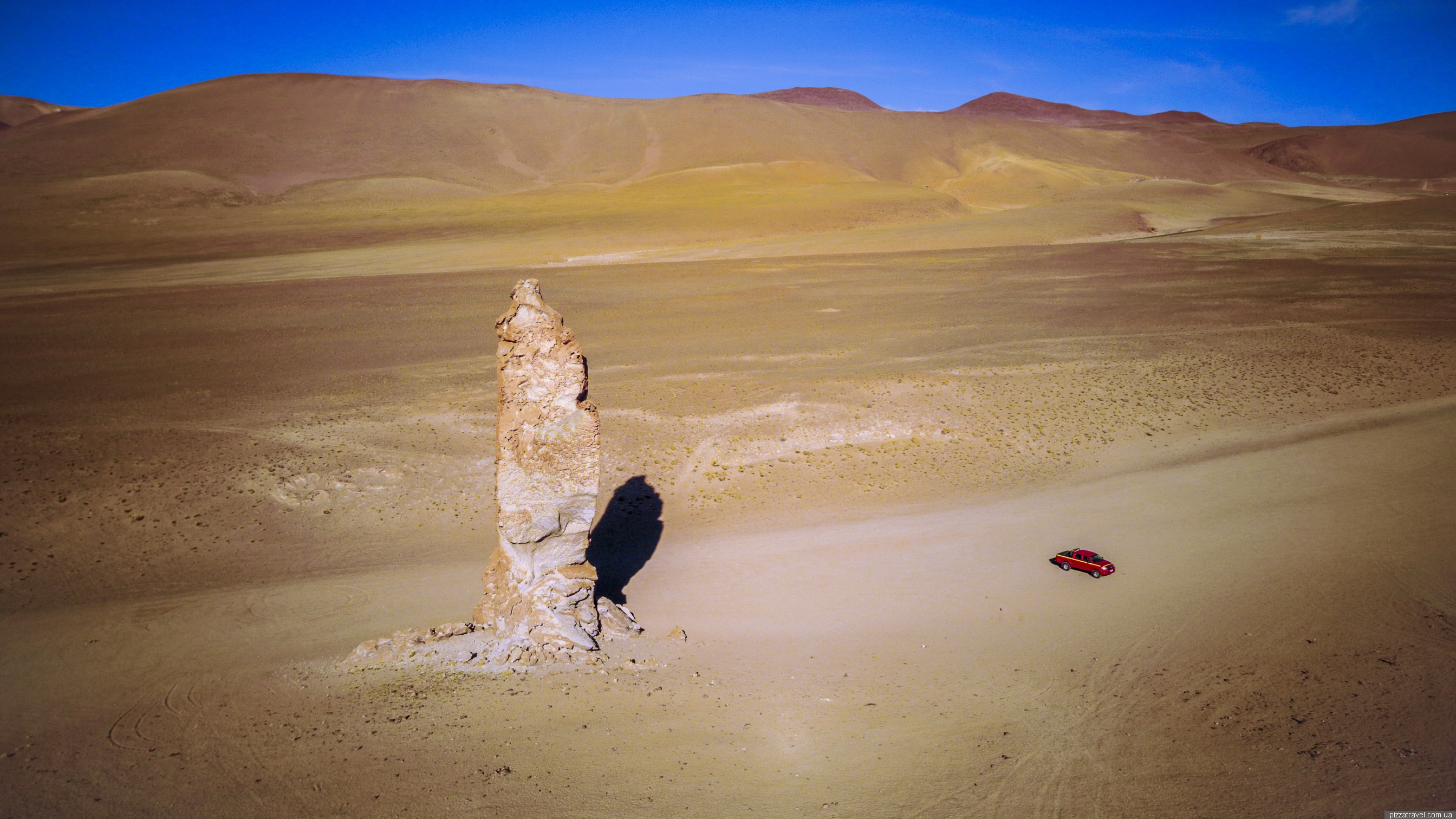
Monjes de la Pacana (Pacana Monks) ©Yuriy Buriak
The road ends and the desert begins. And by the word desert, I mean an absolutely empty, lifeless place, without vegetation, roads, without any pointers. You have to drive here 30 kilometers one way and 30 kilometers back.

Monjes de la Pacana (Pacana Monks) ©Yuriy Buriak
It was really scary. GPS is useless, since there are no roads and it shows just an empty place. But you can use it to record a track to return back. We did not even have a map and rode just at random.
The road is a dirt road with pits and ravines. At least 5 times car stalled due to little power. It's not uncommon that some tourists get stuck in the sand. Since there is no phone connection you will have to wait for other tourists or a minivan with the group.
Near the orange arrow is a steep climb, the most difficult part.

The road to Salar de Tara lake ©Yuriy Buriak
Then begins a long, flat area, almost to the lake. It's not clear where to go. We went just ahead. However from the satellite the road is clearly visible.

The road to Salar de Tara lake ©Yuriy Buriak
But on the ground you're lost. Next pictures are from the automatic drone that flew behind us.

Road to Salar de Tara ©Yuriy Buriak

Road to Salar de Tara ©Yuriy Buriak

Road to Salar de Tara ©Yuriy Buriak
Coordinates of the endpoint S 22 59.068 W 67 18.171. There is a small house with a ranger. You will be asked to enter your details in the visitors' log.

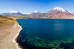
Salar de Tara lake ©Yuriy Buriak
The lake? Yes, it's beautiful. But at this moment we began to feel dizzy and it was necessary to return.

Salar de Tara lake ©Yuriy Buriak

Salar de Tara lake ©Yuriy Buriak

Salar de Tara lake ©Yuriy Buriak

Salar de Tara lake ©Yuriy Buriak

Salar de Tara lake ©Yuriy Buriak

Salar de Tara lake ©Yuriy Buriak
Near the lake there are some marmots.

Salar de Tara lake ©Yuriy Buriak
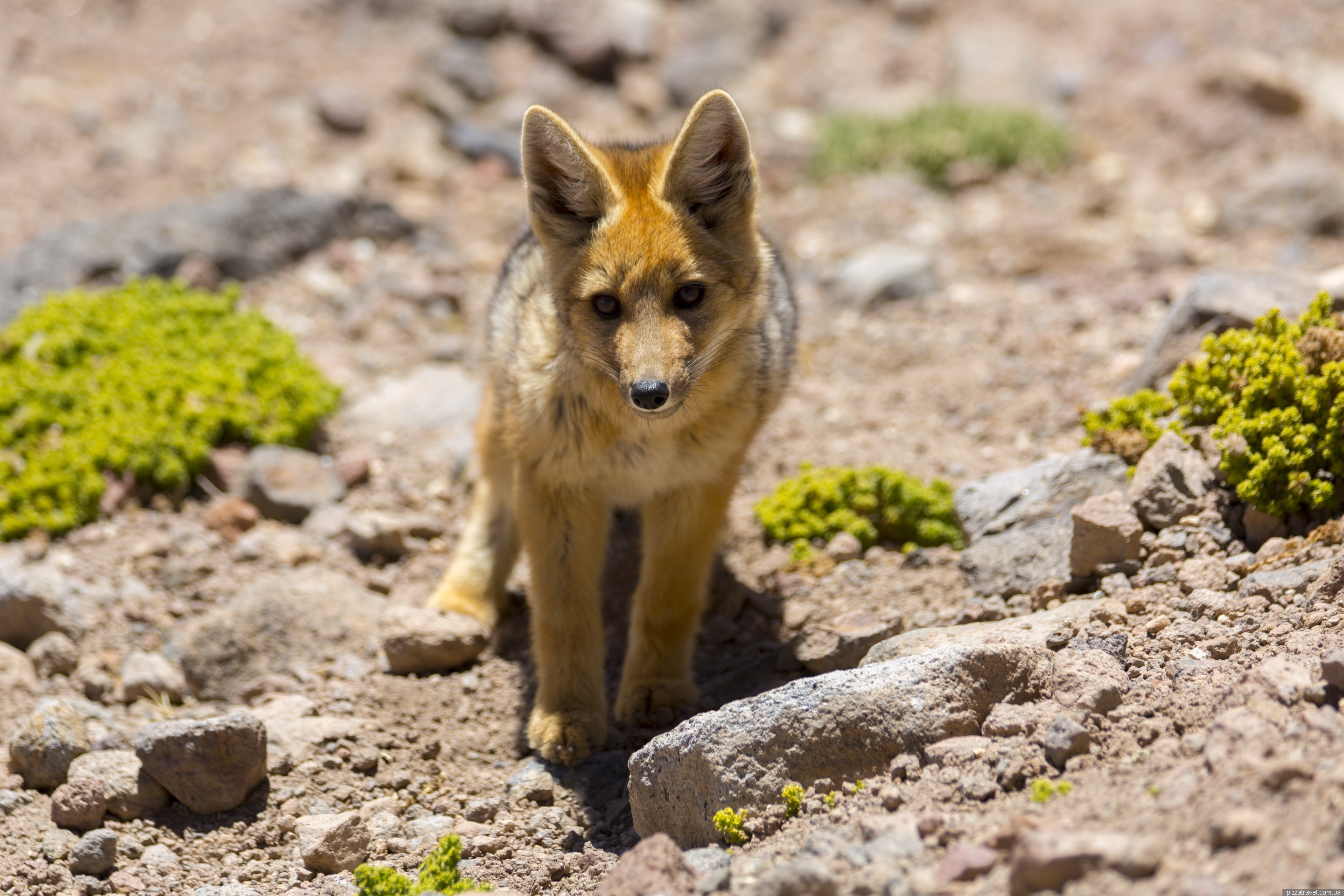
On the way back at an altitude of 4800 meters we found a fox. The foxes in Atacama can be seen very often and their photos appear in the records of travelers. But in most cases people see grown-up foxes who lost their color. And we found a very nice and bright fox pup. Fed him and made photos. It turned out that at such an altitude even just holding a 2.5 kilogram camera was a real problem. After each shot my hands became numb.

Little Fox in the Atacama Desert ©Yuriy Buriak
Salar de Tara lake ©Yuriy Buriak
Getting there: As part of an organized excursion from San Pedro de Atacama. If you go by car follow here S 22 59.068 W 67 18.171.