Vajont Dam ©Yuriy Buriak
We learned about it from one of the episodes of “Seconds from Disaster”.
The dam, 262 meters high, was built in 1961. Even during the construction, a landslide occurred, which caused a 20-meter wave that killed one person. After that, the engineers constantly took measurements of the soil on the slopes and realized that a new landslide was inevitable. Even the approximate date and size of the landslide was calculated.

Vajont Dam ©Yuriy Buriak
On October 9, 1963, engineers and scientists gathered at the top of the dam to look at the impending landslide. Expecting a wave of several tens of meters, the water in the reservoir was previously lowered by 25 meters. What happened next was not expected by anyone.
The landslide really happened, only its size was much more bigger. It is better to look at satellite image, as the consequences are clearly visible even today.
1 - slope of the mountain on which the landslide happened
2 - rock in the reservoir
3 - the dam
4 - Piave river valley, where the wave rushed

Wyont Dam Disaster Scheme ©Yuriy Buriak
At 22:39, a 2 km long landslide (!) descended into the reservoir and the lake turned out to be completely filled with rock. Instead of the predicted 25-meter wave, a wave 250 meters high surged through the dam! The dam itself remained almost intact.
Water rushed into the valley of the Piave River. In 7 minutes 5 villages were destroyed and from 2 to 3 thousand people died.
The slope from which the landslide descended still clearly visible today.

Vajont Dam ©Yuriy Buriak
View of the dam and the valley where the water rushed.
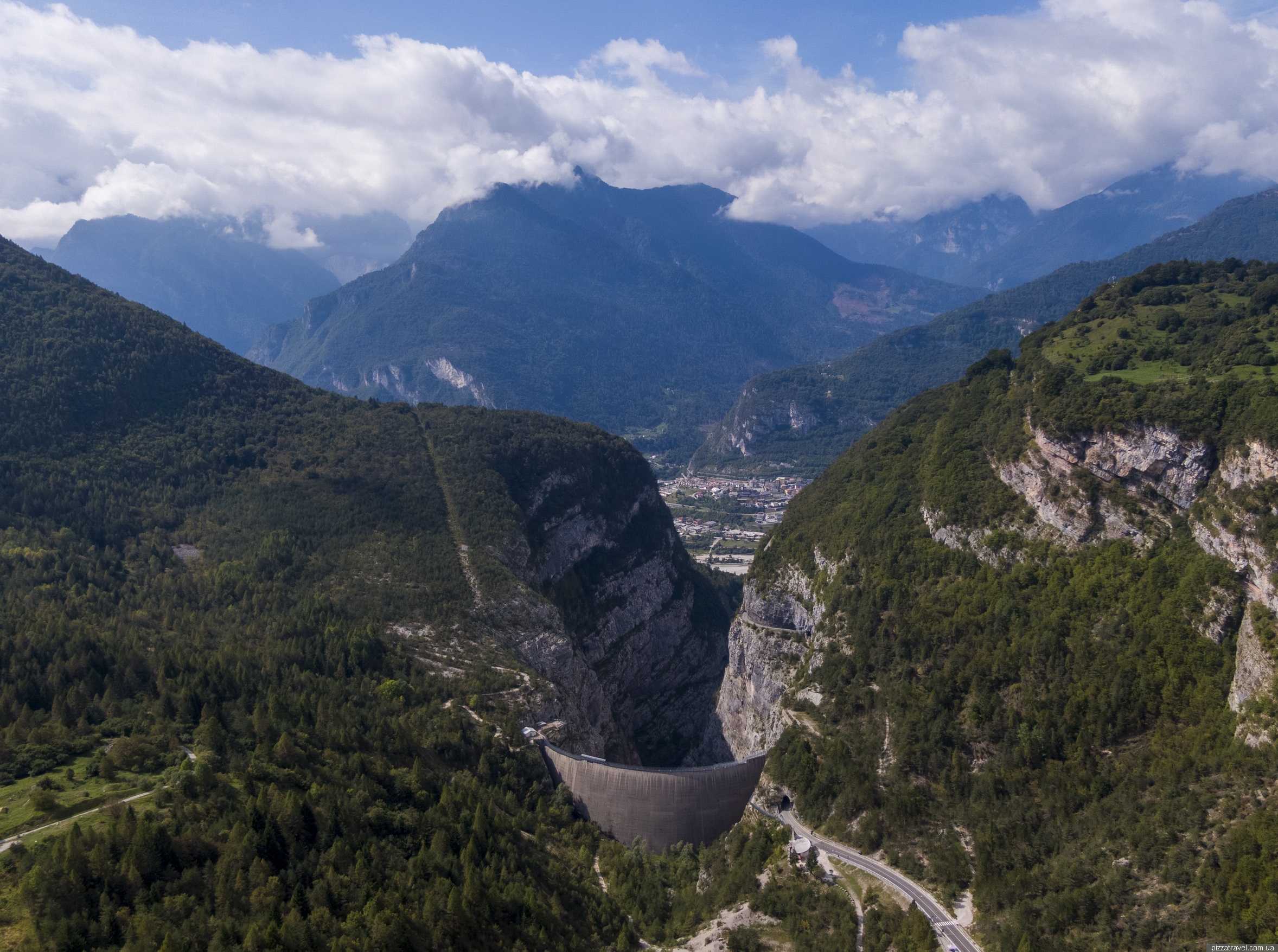
Vajont Dam ©Yuriy Buriak
At the moment, a church and a small memorial have been built near the dam.

Vajont Dam ©Yuriy Buriak

Vajont Dam ©Yuriy Buriak
Getting there: parking near the dam N 46 16.156 E 12 19.912, parking a little higher with a good viewpoint N 46 16.124 E 12 20.143. And here is the toilet N 46 16.185 E 12 20.001.